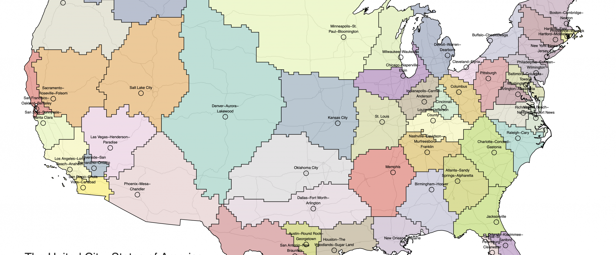
America's state map features numerous perfectly straight lines that seem drawn with a ruler-and they were. These geometric borders reflect political compromises, surveying limitations, and colonial-era decisions made thousands of miles away that continue to shape American geography today.
When looking at a map of the United States, you'll immediately notice something peculiar: many state boundaries are perfectly straight lines, appearing as if drawn with a ruler-which, in fact, they often were. These geometric borders stand in stark contrast to the organic boundaries found in many other countries, where rivers, mountain ranges, and other natural features typically define territorial divisions.
These straight-line borders tell a fascinating story about America's development, reflecting a unique combination of historical circumstances, political expediency, and the practical realities of carving up vast territories during the nation's westward expansion. The grid-like pattern of many state boundaries reveals much about American history, politics, and the very way we conceptualize land ownership and governance.
Colonial Legacy: Early Straight Borders
America's straight borders began with the colonial charters issued by European monarchs. These documents, created an ocean away from the lands they described, often defined colonial territories using simple geometric boundaries.
Royal charters frequently specified colonial boundaries using latitude lines, creating the first straight borders in what would become the United States. For example, the 1629 Massachusetts Bay Colony charter established its northern boundary at 43°43' north latitude and its southern border at 42°2' north.
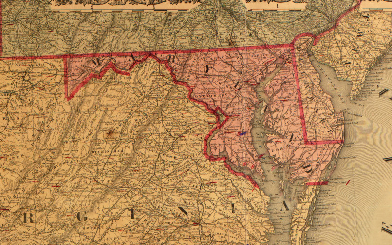
The Mason-Dixon Line, surveyed between 1763 and 1767, became one of America's most famous straight borders. This boundary between Maryland, Delaware, and Pennsylvania was created to resolve territorial disputes between the Penn and Calvert families. The line would later take on additional significance as the cultural boundary between North and South.
Surveying Limitations: Drawing Lines in the Wilderness
When early American surveyors ventured into the wilderness to establish boundaries, they faced enormous practical challenges. In densely forested, mountainous, or otherwise difficult terrain, following natural features like ridgelines was extremely difficult with 18th and 19th century technology.
Straight lines offered a practical solution to these challenges. Surveyors could establish a bearing and follow it, creating boundaries that were relatively simple to mark and map. This approach was far easier than attempting to precisely survey irregular natural features across challenging landscapes.
The tools available to early surveyors-compasses, chains, and theodolites-were best suited to establishing straight lines. As Charles Mason and Jeremiah Dixon demonstrated with their famous line, surveyors could use astronomical observations to establish accurate straight boundaries, even through wilderness.
Political Compromises: Avoiding Conflict
Many straight borders emerged from political compromises designed to resolve or prevent territorial conflicts. When multiple states or territories claimed overlapping lands, a straight line often served as a clean, politically neutral solution.
The Oklahoma Panhandle exists because of political compromise related to slavery. This narrow strip of land couldn't be part of Texas (which permitted slavery) after the Missouri Compromise prohibited slavery north of the 36°30' parallel. It couldn't join Kansas or New Mexico territories either, leaving it as a no-man's-land until eventually becoming part of Oklahoma.
Colorado's perfectly rectangular shape resulted from political decisions rather than geography. Its borders were established by Congress in 1861, creating straight lines that satisfied competing territorial claims while creating a state of convenient, administrable proportions.
Western Expansion and Jefferson's Grid
Perhaps the most significant influence on America's straight-line geography was the Public Land Survey System (PLSS), also known as the Jefferson Grid. Established by the Land Ordinance of 1785, this system imposed a geometric grid on the American landscape, dividing land into townships of six square miles, further subdivided into 36 one-square-mile sections.
Thomas Jefferson, with his love for rational order and geometric precision, was a driving force behind this system. The Jefferson Grid fundamentally shaped how Americans viewed, divided, and settled the western lands. It created a mindset where straight-line boundaries became the default approach to territorial division.
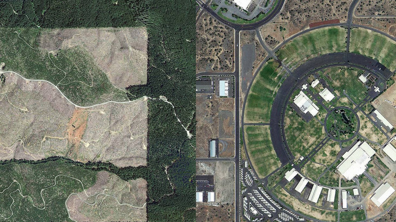
As new territories and states formed during westward expansion, they frequently adopted the straight-line boundaries already established by the PLSS. This system made it easy to create new political entities with clear, unambiguous borders that aligned with the existing survey grid.
Latitude and Longitude as Border Markers
The global coordinate system of latitude and longitude provided convenient, scientifically precise ways to define borders, especially in unmapped territories. Many state boundaries follow specific lines of latitude or longitude, creating perfectly horizontal or vertical borders on maps.
Wyoming and Colorado are both bounded by lines of latitude and longitude, giving them their distinctive rectangular shapes. Wyoming's borders follow 41°N and 45°N latitude and 104°3'W and 111°3'W longitude, creating what's nearly a perfect rectangle (though slightly narrower at the northern edge due to the convergence of longitude lines).
The border between Utah and Colorado follows the 109°W longitude line, while the California-Nevada border follows the 120°W longitude line before angling southeastward. These astronomical boundaries could be established with precision even in remote, unsettled territories.
Rectangular Borders: Efficiency and Practicality
The preference for straight, rectangular state boundaries also reflected administrative efficiency. Regular shapes were easier to govern, map, and organize than territories with complex, irregular boundaries.
The rectangular states of the Midwest and West exemplify this approach. Kansas, Nebraska, Oklahoma, and the Dakotas all feature straight-line boundaries that facilitated orderly settlement and governance. These borders were established while these areas were still territories, with their state boundaries later following these pre-established lines.
This geometric approach to state creation reached its apex with Wyoming and Colorado, the only two states with borders defined almost entirely by lines of latitude and longitude. Their neat rectangular shapes represent the triumph of administrative convenience over geographical realities.
Border Anomalies and Surveying Mistakes
Despite the intention for clean, straight borders, numerous surveying errors and mistakes created anomalies in what should have been perfectly straight state boundaries.
The Michigan-Ohio border was supposed to be a straight line, but surveying errors led to the Toledo War, a mostly bloodless territorial dispute. The eventual compromise gave Toledo to Ohio while Michigan received the Upper Peninsula as compensation-a border dispute that permanently altered Michigan's shape.
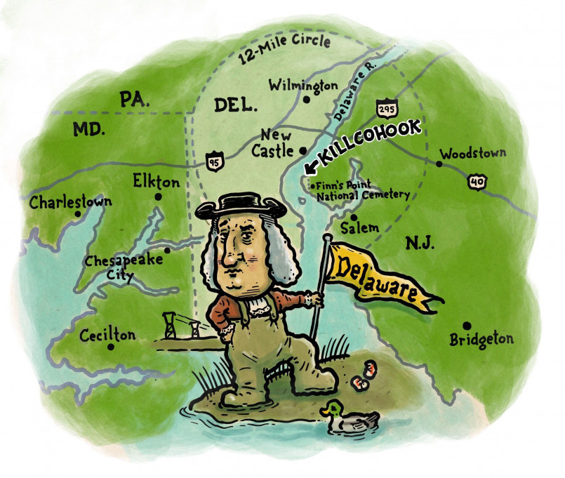
The border between Delaware and Pennsylvania includes a curious circular arc, known as the Twelve-Mile Circle. This unusual boundary feature originated in a 1681 royal charter that granted William Penn land north of a circle drawn at a twelve-mile radius from the town of New Castle.
Natural vs. Artificial Borders
The contrast between America's natural borders (following rivers, mountain ranges, or other geographical features) and its artificial straight-line borders highlights different approaches to territorial definition.
Eastern states typically have more irregular boundaries following natural features, reflecting their earlier establishment and the greater importance of rivers for transportation and commerce in the colonial era. The Mississippi River forms parts of the boundaries of ten different states, while the Appalachian Mountains influenced many eastern state borders.
Western states, established later during the era of railroads and telegraphs, relied less on rivers for transportation and communication. This, combined with the Jefferson Grid system already in place, led to more geometric, straight-line boundaries disconnected from natural geography.
State Border Disputes Throughout History
America's straight-line borders have generated numerous boundary disputes throughout history, many of which continue to this day. These conflicts reveal the inherent problems with imposing geometric boundaries on a complex landscape.
The Georgia-Tennessee border dispute stems from an 1818 surveying error that placed the border about a mile south of its intended location along the 35th parallel. This mistake became increasingly significant when Georgia experienced water shortages, as the incorrectly drawn border prevented Georgia's access to the Tennessee River.
New Jersey and New York have long disputed their boundary in the Hudson River and New York Harbor, with competing claims dating back to colonial times. The precise location of Ellis Island became a point of contention that was only resolved by a 1998 Supreme Court decision, which divided the island between the two states.
Cultural Impacts of Straight-Line Borders
The prevalence of straight borders has had profound cultural and psychological impacts on American society, influencing everything from land use patterns to our very conception of space and ownership.
The Jefferson Grid's imposition of a geometric order on the landscape reflects a distinctly American approach to the natural world-one that emphasizes rational control, order, and efficiency. This grid system facilitated rapid settlement and development but also represented a fundamental reorganization of the landscape away from natural patterns.
Indigenous perspectives on land and territory, which typically focused on natural features and traditional use areas rather than geometric boundaries, were largely disregarded as straight-line borders were drawn across their traditional territories. These artificial divisions often split tribal lands and communities, creating lasting challenges for tribal sovereignty.
Today, America's straight-line borders serve as a visible reminder of our national history-of colonial charters, political compromises, surveying limitations, and the grand project of imposing order on a continent. These ruler-straight boundaries, for all their artificial nature, have become an integral part of American identity and geography.
Frequently Asked Questions About 12 Fascinating Reasons Why US States Have Straight Borders
Why do western states have more straight borders than eastern states?
Western states have more straight borders because they were created later in American history when surveying technology had improved and the Jefferson Grid system was already in place. Eastern states formed earlier, often following colonial boundaries that were more likely to use natural features like rivers and mountain ranges as borders. Western states were also mapped and divided while still largely unsettled, making it easier to impose geometric boundaries without disrupting established communities.
Were straight borders cheaper or easier to create than following natural features?
Yes, straight borders were generally both cheaper and easier to survey than irregular natural boundaries. Creating a straight-line border required establishing accurate points at each end and then following a compass bearing, while mapping a river or mountain range required extensive surveying of every twist and turn. Straight lines could also be accurately described in legal documents with just a few coordinates, making them administratively simpler.
What is the Jefferson Grid and how did it influence state boundaries?
The Jefferson Grid, officially called the Public Land Survey System (PLSS), was established in 1785 to systematically survey and divide western lands into townships and sections. This geometric system created a grid of square-mile sections across much of the country, establishing a pattern of straight lines on the landscape. As new states formed, their boundaries often followed these existing survey lines, reinforcing the preference for straight-line borders.
Which state has the most perfectly rectangular shape?
Wyoming is considered the most perfectly rectangular state. Its borders follow lines of latitude and longitude, creating an almost perfect rectangle (slightly narrower at the north due to the convergence of longitude lines). Colorado is a close second, also with four straight sides, but Wyoming's shape is closer to a true rectangle with right angles at its corners.
Have straight borders caused problems between states?
Yes, straight borders have caused numerous problems and disputes between states. Surveying errors created contested areas, such as the long-running Georgia-Tennessee border dispute that affects water rights to the Tennessee River. Straight-line borders that ignored natural features like watersheds have led to water allocation conflicts, particularly in the arid West. Even when accurately drawn, these artificial borders sometimes split communities or create jurisdictional challenges.
What is the Four Corners Monument and why is it significant?
The Four Corners Monument marks the only point in the United States where four states meet-Arizona, Colorado, New Mexico, and Utah. This unique intersection exists because all four states have straight-line borders that meet at right angles. The monument has become a popular tourist destination where visitors can physically be in four states simultaneously, standing with limbs in different states.
