Alaska experiences more earthquakes than all other 49 states combined. This seismic hotspot averages over 20,000 quakes annually due to its position along the Pacific Ring of Fire, where tectonic plate boundaries collide and slide past each other in a geological dance that's been ongoing for millions of years.
Alaska shakes more than any other state in the USA. With over 20,000 earthquakes recorded annually, this northern frontier experiences more seismic activity than all other 49 states combined. This remarkable geological phenomenon has shaped both the physical landscape and the cultural identity of America's largest state. Understanding why Alaska trembles so frequently requires exploring its unique position in Earth's tectonic framework.
From small tremors that go unnoticed to massive quakes that reshape coastlines, Alaska's relationship with earthquakes is complex and ongoing. The state's location along the boundary of major tectonic plates makes it particularly vulnerable to seismic events that have profound implications for residents, infrastructure, and the natural environment.
Alaska's Position on the Ring of Fire
Alaska sits along the northern edge of the Pacific Ring of Fire, a 25,000-mile horseshoe-shaped zone encircling the Pacific Ocean where approximately 90% of the world's earthquakes occur. This volatile belt marks the boundaries between several major and minor tectonic plates that are constantly moving against one another.
The Ring of Fire is characterized by a nearly continuous series of oceanic trenches, volcanic arcs, volcanic belts, and plate movements. Alaska's southern coast forms a critical segment of this ring, where the Pacific Plate converges with the North American Plate, creating immense geological stress.
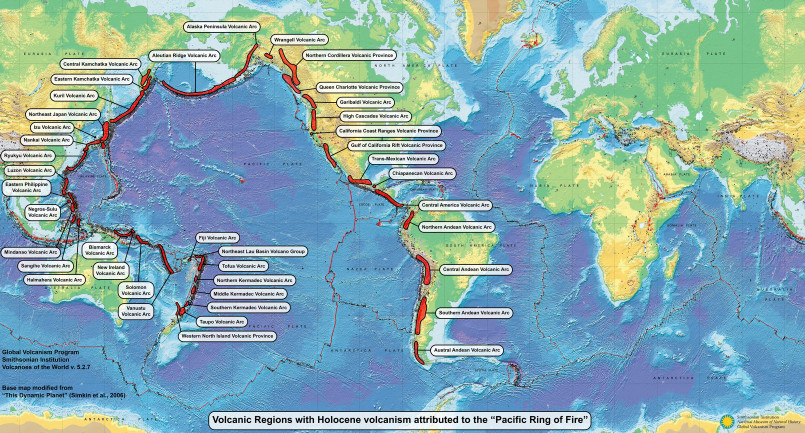
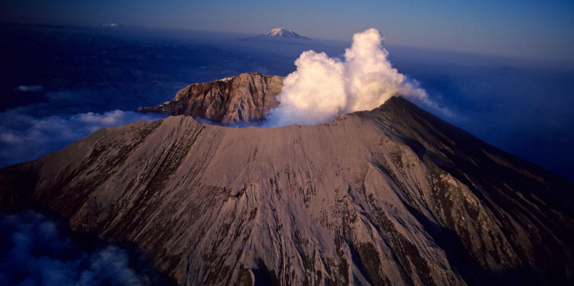
This position makes Alaska particularly susceptible to both shallow and deep earthquakes, as well as volcanic activity. The state hosts over 130 volcanoes and volcanic centers, many of which remain active today-another consequence of its Ring of Fire location.
Tectonic Plate Boundaries Beneath Alaska
Alaska sits at the intersection of multiple tectonic plates, creating a complex geological setting. The primary boundary involves the Pacific Plate moving northward at approximately 5.5 centimeters per year, colliding with and sliding beneath the North American Plate in a process called subduction.
This collision zone creates the Aleutian Trench, a deep oceanic trench extending for over 2,100 miles along the southern coast of Alaska and the Aleutian Islands. The trench reaches depths of nearly 25,000 feet below sea level, marking where the Pacific Plate begins its descent beneath Alaska.
In addition to this primary boundary, Alaska is affected by several smaller plates and microplates, including the Yakutat Block, which is currently colliding with southern Alaska. This complex interaction creates multiple fault systems throughout the state, each capable of generating significant earthquakes.
Subduction Zone Dynamics
The Alaska-Aleutian subduction zone is one of the most seismically active in the world. When the Pacific Plate subducts beneath the North American Plate, it doesn't slide smoothly. Instead, the plates become locked together due to friction, causing stress to build up over time.
Eventually, when this accumulated stress exceeds the frictional forces keeping the plates locked, they suddenly slip past one another, releasing enormous amounts of energy in the form of earthquakes. This process, known as elastic rebound, is responsible for Alaska's most powerful seismic events.
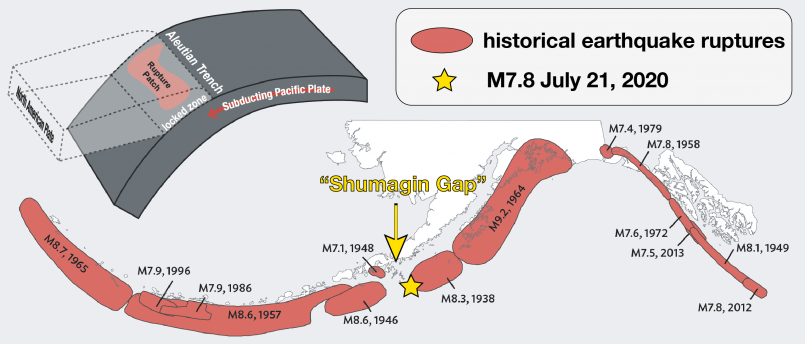
The subduction zone can generate several types of earthquakes:
- Megathrust earthquakes occur at the interface between the two plates and can be enormously powerful, like the 1964 Great Alaska Earthquake
- Benioff zone earthquakes occur within the subducting Pacific Plate as it bends and descends
- Crustal earthquakes occur in the overriding North American Plate due to deformation
The depth of these earthquakes varies considerably, from shallow events near the surface to deep quakes occurring hundreds of kilometers below.
Historic Alaskan Earthquakes
Alaska's seismic history is punctuated by several catastrophic events that have shaped understanding of earthquake science. The most notable was the 1964 Great Alaska Earthquake (also known as the Good Friday Earthquake), which struck on March 27, 1964, with a magnitude of 9.2-the second most powerful earthquake ever recorded globally.
This megathrust earthquake lasted nearly four minutes and triggered tsunamis that caused destruction throughout the Gulf of Alaska, Kodiak Island, and Prince William Sound. The earthquake and subsequent tsunamis caused 131 deaths and approximately $2.3 billion in damage (in 2022 dollars).
Other significant historic Alaskan earthquakes include:
- The 1958 Lituya Bay earthquake (M7.8) triggered a megatsunami reaching 1,720 feet-the tallest wave ever recorded
- The 2002 Denali Fault earthquake (M7.9) ruptured 209 miles of surface along multiple faults
- The 2018 Anchorage earthquake (M7.1) caused significant infrastructure damage but remarkably few casualties
These events have provided scientists with valuable data about subduction zone dynamics and have influenced building codes and emergency response protocols throughout Alaska.
Earthquake Monitoring Systems in Alaska
Given Alaska's extraordinary seismic activity, the state has developed sophisticated monitoring systems. The Alaska Earthquake Center, operated by the University of Alaska Fairbanks, maintains a network of over 400 seismic stations throughout the state.
These sensors continuously record ground motion data, allowing scientists to detect, locate, and measure earthquakes in real time. The center typically catalogs between 15,000 to 30,000 earthquakes each year in Alaska, though the vast majority are too small to be felt by humans.
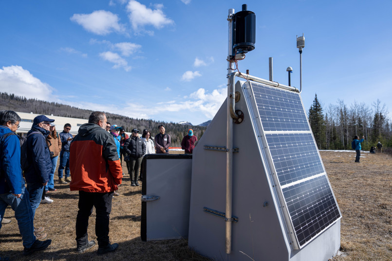
In addition to land-based monitoring, undersea sensors help detect submarine earthquakes that might generate tsunamis. The National Tsunami Warning Center in Palmer, Alaska, works in conjunction with these monitoring systems to issue alerts when necessary.
Advanced technologies like GPS networks also measure subtle ground deformation, helping scientists understand how stress accumulates along fault lines between major earthquakes-potentially improving future earthquake prediction capabilities.
Impact on Alaskan Life and Infrastructure
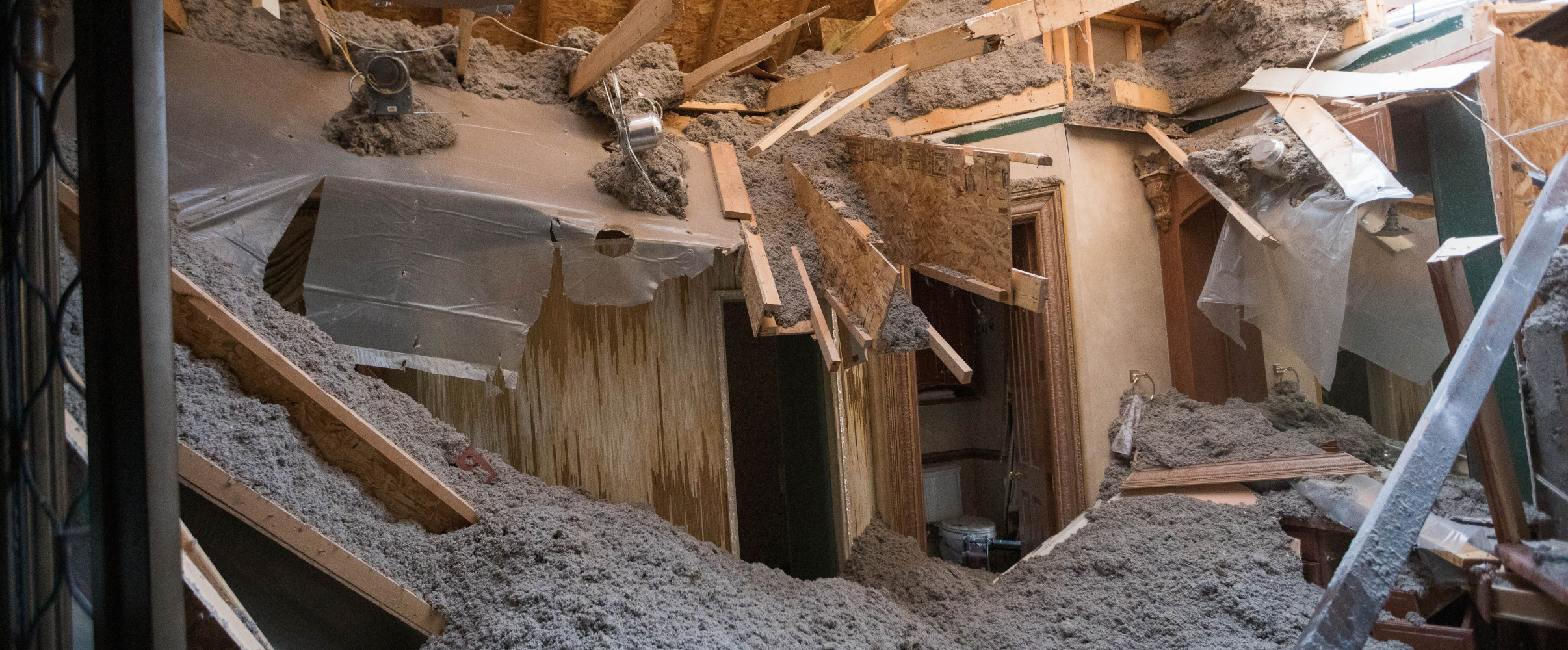
Living with frequent seismic activity has profoundly influenced Alaskan culture, architecture, and infrastructure. Building codes in Alaska are among the strictest in the United States, requiring structures to withstand significant ground motion.
Modern buildings in Anchorage and other major cities incorporate seismic isolation systems, flexible foundations, and reinforced structural elements. Critical infrastructure like bridges, hospitals, and power plants are designed with earthquake resistance as a primary consideration.
The Trans-Alaska Pipeline System, which carries oil 800 miles from Prudhoe Bay to Valdez, exemplifies adaptive engineering. The pipeline is built on specialized slider supports that allow it to move horizontally up to 20 feet and vertically up to 5 feet during an earthquake-a design feature that proved effective during the 2002 Denali earthquake.
For Alaskans, earthquake preparedness is a part of everyday life. Schools regularly conduct earthquake drills, and many residents maintain emergency supplies. This preparedness culture has contributed to relatively low casualty rates despite the frequency and magnitude of seismic events.
Future Seismic Activity Predictions
Geologists and seismologists continue studying Alaska's complex fault systems to better understand future earthquake risks. Current research indicates that major seismic events will certainly continue, though predicting exact timing remains impossible.
Of particular concern is the Yakutat Block collision in southeastern Alaska, where continued convergence is building stress that will eventually be released in future earthquakes. Similarly, portions of the Alaska-Aleutian subduction zone that haven't experienced major slippage in recent history may be accumulating strain for future large events.
Climate change introduces additional variables, as glacial isostatic adjustment-the rebounding of land formerly depressed by glaciers-alters stress patterns in the Earth's crust. Some research suggests this process may influence seismic activity in parts of Alaska where glaciers are rapidly retreating.
While the frequency and location of earthquakes can be estimated based on historical patterns and ongoing monitoring, Alaskans will continue to live with uncertainty as part of their relationship with this dynamically active landscape.
Frequently Asked Questions About Why Alaska Experiences 20,000+ Earthquakes Annually: The Ring of Fire Explained
Why does Alaska have more earthquakes than other US states?
Alaska experiences more earthquakes because it sits at the boundary between the Pacific and North American tectonic plates. This boundary is part of the Pacific Ring of Fire, where about 90% of the world's earthquakes occur. The Pacific Plate is subducting (sliding beneath) the North American Plate at a rate of about 5.5 centimeters per year, creating tremendous geological pressure that's released through thousands of earthquakes annually.
How many earthquakes does Alaska typically experience each year?
Alaska typically experiences over 20,000 earthquakes annually. While the vast majority are too small to be felt by humans (below magnitude 3.0), the state averages about 1,000 earthquakes of magnitude 3.0 or greater each year. This means Alaska experiences about 55 earthquakes per day on average, making it the most seismically active state in the United States by a significant margin.
What was the largest earthquake ever recorded in Alaska?
The largest earthquake ever recorded in Alaska was the 1964 Great Alaska Earthquake (also known as the Good Friday Earthquake), which had a magnitude of 9.2. This remains the second-largest earthquake ever recorded worldwide. It occurred on March 27, 1964, lasted nearly four minutes, and caused extensive damage through ground shaking and subsequent tsunamis. The earthquake killed 131 people and caused approximately $2.3 billion in damage (in modern dollars).
Are Alaskan buildings designed differently because of earthquake risk?
Yes, Alaskan buildings, especially in urban areas like Anchorage, are constructed with some of the strictest seismic building codes in the United States. Modern structures incorporate features like flexible foundations, reinforced connections, and seismic isolation systems. Critical infrastructure, including the Trans-Alaska Pipeline, features specialized engineering to withstand significant ground motion. These adaptations reflect the necessary integration of earthquake resilience into everyday Alaskan infrastructure.
Can scientists predict when the next major earthquake will hit Alaska?
Scientists cannot predict the exact timing of individual earthquakes in Alaska or elsewhere. However, seismologists can identify areas with higher probability of future earthquakes based on factors like historical seismic patterns, accumulated stress on fault lines, and ongoing plate movements. While the Alaska Earthquake Center and other agencies maintain extensive monitoring networks that detect thousands of earthquakes annually, precise prediction remains beyond current scientific capabilities.
Do all parts of Alaska experience earthquakes equally?
No, earthquake activity varies significantly across Alaska. The most seismically active regions are southern Alaska (particularly around Cook Inlet and Prince William Sound), the Alaska Peninsula, and the Aleutian Islands chain, where the Pacific and North American plates directly interact. Interior and northern Alaska experience fewer and generally less powerful earthquakes, though no part of the state is entirely free from seismic risk. The distribution reflects the varied tectonic influences across this geologically complex state.
