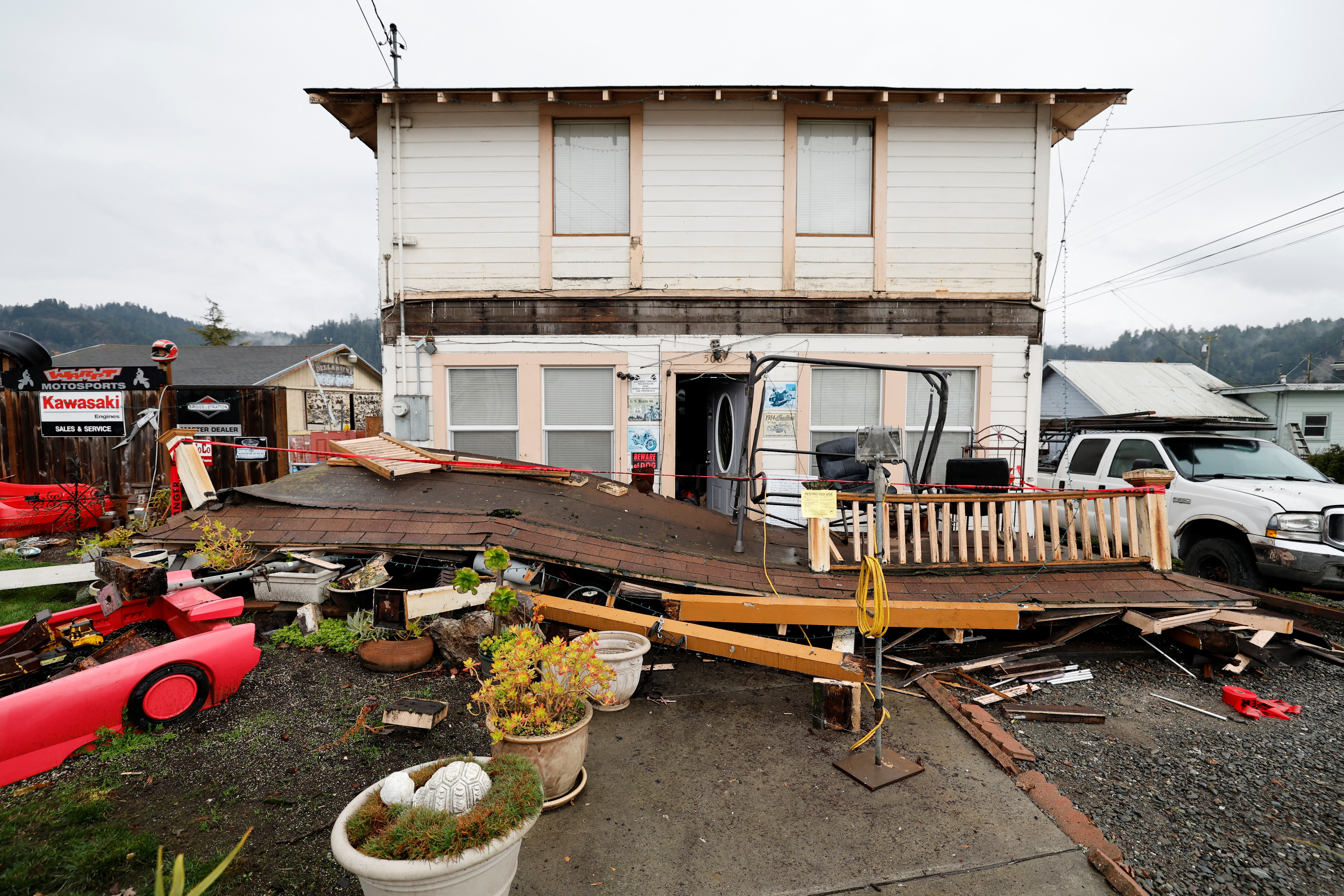
While earthquakes can technically occur anywhere, certain states experience significantly more seismic activity than others. From California's infamous San Andreas Fault to lesser-known hotspots in Alaska and Hawaii, these states face constant threats from earth-shaking events that shape both their landscapes and disaster preparedness approaches.
When the ground begins to shake, few natural events can match the immediate terror and potential destruction of a powerful earthquake. While many Americans may think of earthquakes as primarily a West Coast concern, seismic activity occurs across the United States with varying degrees of frequency and intensity. Understanding which states face the highest earthquake risks is crucial for emergency preparedness, infrastructure planning, and public safety.
The following ranking of America's most earthquake-prone states considers factors including historical seismic activity, fault line presence, recorded earthquake frequency, and the potential magnitude of future events. While low-level earthquakes occur daily across the country, these states experience the most significant and potentially damaging seismic events.
California: Earthquake Central
California easily claims the title of America's most earthquake-vulnerable state in the public consciousness, and the data backs this perception. The state experiences over 10,000 earthquakes annually, though most are too small to be felt. The infamous San Andreas Fault, stretching nearly 800 miles through California, creates a boundary between the Pacific and North American tectonic plates that generates significant seismic activity.
Notable California earthquakes include the devastating 1906 San Francisco earthquake (estimated magnitude 7.9) that destroyed much of the city and the 1994 Northridge earthquake (magnitude 6.7) that caused over $20 billion in damage. The state's earthquake risk is particularly concentrated along coastal regions and through the central valley.

California has implemented some of the world's strictest building codes in response to its seismic risk, requiring structures to withstand substantial ground movement. The state also pioneered early warning systems like ShakeAlert, which can provide seconds of crucial warning before shaking begins.
Alaska: Highest Magnitude Quakes
While California experiences more frequent earthquakes, Alaska holds the record for the most powerful earthquake in U.S. history-the 1964 Great Alaska Earthquake with a magnitude of 9.2. This massive tremor caused tsunamis, landslides, and ground liquefaction that reshaped coastlines and destroyed entire communities.
Alaska experiences more earthquakes than any other U.S. state, with over 43,000 recorded seismic events annually. This extraordinary level of activity results from Alaska's position along the Ring of Fire, where the Pacific Plate subducts beneath the North American Plate. The state's Aleutian Trench is particularly active, generating powerful earthquakes and tsunami risks that extend throughout the Pacific Basin.
Despite its sparse population, Alaska's major communities, including Anchorage, face significant earthquake threats, requiring specialized building practices to withstand both ground shaking and permafrost conditions.
Hawaii: Volcanic Seismicity
Hawaii's earthquake risk stems primarily from its active volcanic systems rather than traditional tectonic plate boundaries. The Hawaiian Islands are essentially a chain of massive volcanoes, with the Big Island hosting some of the world's most active volcanic systems, including Kilauea and Mauna Loa.
Volcanic activity inherently generates earthquakes as magma moves beneath the surface, creating pressure changes and ground deformation. The Big Island experiences thousands of earthquakes yearly, with clusters of tremors often preceding volcanic eruptions.

The largest recorded Hawaiian earthquake occurred in 1868 with an estimated magnitude of 7.9, causing significant damage and triggering deadly landslides. More recently, the 2018 eruption of Kilauea was accompanied by over 60,000 recorded earthquakes in a three-month period, demonstrating the direct relationship between volcanic and seismic activity in the islands.
Washington: Cascadia Subduction Zone
Washington state faces earthquake threats from multiple sources, but the most concerning is the Cascadia Subduction Zone-a 700-mile fault where the Juan de Fuca Plate dives beneath the North American Plate. This massive fault is capable of generating "megathrust" earthquakes exceeding magnitude 9.0.
Geological evidence shows that Cascadia produces catastrophic earthquakes approximately every 300-500 years, with the last occurring in January 1700. This event generated a tsunami that reached Japan and left geological evidence throughout the Pacific Northwest. The region is now within the timeframe where another major event could occur.
Beyond the Cascadia threat, Washington also contains the Seattle Fault, which runs directly beneath the state's most populous city. A major earthquake on either fault system could cause widespread destruction, liquefaction of soils, and tsunami hazards along coastal areas.
Nevada: Walker Lane
Nevada ranks among America's most seismically active states despite receiving less attention than coastal earthquake zones. Western Nevada, particularly along the Walker Lane fault system, experiences regular earthquake activity. This fault zone, which roughly parallels the California-Nevada border, accommodates up to 25% of the motion between the Pacific and North American plates.
The state has experienced multiple significant earthquakes, including a sequence of seven magnitude 6.5 or greater events between 1915 and 1954. More recently, in 2020, a magnitude 6.5 earthquake struck near Tonopah in western Nevada, demonstrating the ongoing seismic activity in the region.
Nevada's earthquake risk is particularly relevant considering the rapid population growth in areas like Reno and Las Vegas, where building codes have been strengthened in recent decades to address seismic concerns.
Oregon: Pacific Ring of Fire
Like Washington, Oregon faces significant earthquake risks from the Cascadia Subduction Zone along its coast. When this fault eventually ruptures, western Oregon could experience minutes of violent shaking, landslides, liquefaction, and a massive tsunami threatening coastal communities with waves potentially exceeding 100 feet in height.
Beyond the Cascadia threat, Oregon contains numerous smaller fault systems, particularly in the Portland metropolitan area and throughout the Cascade Range. These faults can generate moderate earthquakes capable of significant local damage, especially to older structures not built to modern seismic standards.

Oregon has been working to improve earthquake resilience through updated building codes, infrastructure assessments, and public education campaigns, though many older structures remain vulnerable to seismic events.
Idaho: Intermountain Seismic Belt
Idaho's earthquake risk stems from its position within the Intermountain Seismic Belt, a zone of earthquake activity that extends from northwestern Montana through Wyoming, Idaho, and Utah. Eastern Idaho experiences the most frequent seismic activity, particularly in the region near Yellowstone National Park.
The state's most significant recorded earthquake was the 1983 Borah Peak earthquake, a magnitude 6.9 event that killed two people and caused extensive property damage. This earthquake created a visible fault scarp (cliff) and raised Mount Borah, Idaho's tallest peak, by approximately 7 feet.
More recently, in March 2020, a magnitude 6.5 earthquake struck near Stanley in central Idaho, becoming the second-largest earthquake in state history and sending tremors felt across six states. This event reminded residents of the ongoing seismic risks in what many incorrectly perceive as a geologically stable region.
Wyoming: Yellowstone Supervolcano
Wyoming's earthquake risk is dominated by the presence of the Yellowstone Caldera-a massive supervolcano that experiences constant low-level seismic activity as magma and hydrothermal systems move beneath the surface. Yellowstone averages 1,500-2,500 earthquakes annually, making it one of the most seismically active regions in the country.
Beyond Yellowstone, Wyoming contains portions of both the Intermountain Seismic Belt and the Teton Fault, which runs along the eastern base of the Teton Range near Jackson. The Teton Fault is capable of producing earthquakes exceeding magnitude 7.0, though it has not generated a major event in historical times.
Wyoming's most powerful recorded earthquake was the 1959 Hebgen Lake earthquake (magnitude 7.3) near the Montana border, which caused a massive landslide that killed 28 people and permanently altered the regional landscape.
Utah: Wasatch Fault
Utah's earthquake risk centers on the Wasatch Fault Zone, which runs for approximately 240 miles along the western edge of the Wasatch Mountain Range. This fault system passes through the state's most heavily populated corridor, including the Salt Lake City metropolitan area, putting over 80% of Utah's population at seismic risk.
Geological evidence indicates that the Wasatch Fault generates magnitude 7.0 or greater earthquakes approximately every 350 years, with segments of the fault having last ruptured between 200 and 1,400 years ago. This suggests the region is within the timeframe for another significant event.
In March 2020, a magnitude 5.7 earthquake struck near Salt Lake City, causing moderate damage and serving as a reminder of the region's seismic vulnerability. Utah has responded to these threats with enhanced building codes and public awareness campaigns, though many older structures remain at risk.
Montana: Western Seismic Activity
Montana's earthquake risk is concentrated in its western regions along the Intermountain Seismic Belt. The state has experienced several significant earthquakes, including the devastating 1959 Hebgen Lake earthquake that triggered a massive landslide, damming the Madison River and creating what is now known as Earthquake Lake.
Western Montana experiences hundreds of small earthquakes annually, with periodic larger events capable of significant damage. The three most seismically active areas include the Flathead Lake region, the Helena area, and the Yellowstone region near the Wyoming border.
Montana's earthquake risk is particularly concerning for older infrastructure and buildings constructed before modern seismic standards were implemented. Many communities have limited resources for seismic retrofitting, though awareness of earthquake risks has increased in recent decades.
Earthquake Preparedness Basics
For residents of earthquake-prone states, preparation is essential. Experts recommend several key preparedness steps regardless of your location:
1. Create an emergency plan including meeting points, communication strategies, and evacuation routes
2. Assemble emergency kits with water, non-perishable food, medications, flashlights, batteries, first aid supplies, and cash
3. Secure heavy furniture and appliances to walls using appropriate brackets
4. Know how to shut off gas, water, and electricity if lines are damaged
5. Practice the "Drop, Cover, and Hold On" technique-drop to the ground, take cover under sturdy furniture, and hold on until shaking stops

While no amount of preparation can completely eliminate earthquake risks, understanding your state's seismic profile and taking appropriate precautions can significantly improve your chances of safely weathering these powerful natural events.
Frequently Asked Questions About 10 Most Earthquake-Prone States in America Ranked by Seismic Risk
Which US state experiences the most earthquakes per year?
Alaska experiences the most earthquakes annually, with approximately 43,000 recorded seismic events each year. This is significantly more than California, which averages about 10,000 earthquakes annually. Alaska's high seismic activity is due to its position along the Pacific Ring of Fire and the subduction of the Pacific Plate beneath the North American Plate.
What was the strongest earthquake ever recorded in the United States?
The strongest earthquake ever recorded in the United States was the 1964 Great Alaska Earthquake (also called the Good Friday Earthquake), which had a magnitude of 9.2. This megathrust earthquake lasted approximately 4.5 minutes, triggered tsunamis, and caused extensive damage throughout south-central Alaska. The earthquake and resulting tsunamis killed 131 people and caused about $311 million in damage (equivalent to over $2.8 billion today).
Are there any eastern US states at risk for significant earthquakes?
Yes, several eastern states face earthquake risks despite being far from tectonic plate boundaries. The New Madrid Seismic Zone affects parts of Missouri, Arkansas, Tennessee, Kentucky, and Illinois, producing major earthquakes in 1811-1812 that rang church bells in Boston. The Eastern Tennessee Seismic Zone and the Ramapo Fault System (affecting New York and New Jersey) also present earthquake hazards. While less frequent than western earthquakes, eastern earthquakes can affect larger areas due to different crustal properties.
How do volcanic eruptions relate to earthquakes in Hawaii?
In Hawaii, earthquakes and volcanic activity are directly connected. As magma moves beneath the surface toward an eruption, it creates pressure changes and breaks rock, generating earthquake swarms. These volcanic earthquakes often increase in frequency and intensity before an eruption. During the 2018 Kilauea eruption, over 60,000 earthquakes were recorded in just three months. Hawaiian earthquakes can also occur due to the immense weight of the volcanoes causing the oceanic crust to flex.
What makes the Cascadia Subduction Zone so dangerous?
The Cascadia Subduction Zone is exceptionally dangerous because it can produce "megathrust" earthquakes exceeding magnitude 9.0 that affect the entire Pacific Northwest (Washington, Oregon, and northern California). These earthquakes could last 3-5 minutes, causing catastrophic damage to major cities like Seattle and Portland. The subduction zone also generates tsunamis that would reach coastal communities within 15-30 minutes, potentially exceeding 100 feet in height in some locations. The fault historically ruptures every 300-500 years, with the last major event in 1700.
How do earthquake building codes differ between high-risk and low-risk states?
High-risk states like California have implemented stringent seismic building codes requiring structures to withstand significant ground movement. These include requirements for flexible connections, reinforced foundations, shear walls, and regular seismic retrofitting of older buildings. In contrast, lower-risk states often adopt less stringent requirements or may only apply enhanced codes to critical infrastructure like hospitals and schools. This disparity means identical buildings in different states may have vastly different abilities to withstand earthquakes.


