The United States is home to some of the world's most diverse desert landscapes. From the iconic saguaro-dotted Sonoran to the vast salt flats of the Great Basin, these arid wonderlands harbor extraordinary biodiversity and geological marvels that have shaped America's natural and cultural heritage.
The United States encompasses a remarkable diversity of desert landscapes, from scorching lowland basins to high-elevation plateaus. These arid regions, receiving less than 10 inches of rainfall annually, cover approximately 500,000 square miles of American terrain. Though often perceived as barren wastelands, these deserts support complex ecosystems with uniquely adapted plants and animals found nowhere else on Earth.
Each desert has its distinctive character, shaped by geological forces, elevation, and climate patterns. From the otherworldly Joshua trees of the Mojave to the majestic saguaro cacti of the Sonoran, America's deserts offer unparalleled natural beauty and scientific significance. Let's explore the largest and most notable desert regions across the United States.
Great Basin Desert
The Great Basin Desert holds the distinction of being America's largest desert, covering approximately 190,000 square miles across Nevada, Utah, Idaho, and Oregon. Unlike the hot deserts of the Southwest, the Great Basin is a cold desert with harsh winters and mild summers, situated between the Sierra Nevada and Wasatch mountain ranges.
What makes this desert unique is its internal drainage system - no rivers flowing to the ocean - creating hundreds of mountain-bounded valleys. The landscape features vast sagebrush plains, salt flats like the Bonneville Salt Flats, and isolated mountain ranges referred to as "sky islands."
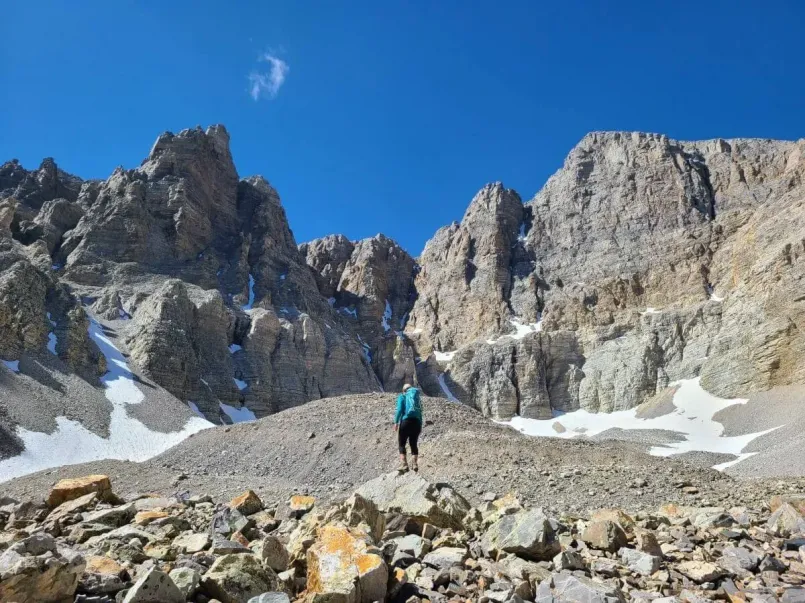
Great Basin National Park showcases the desert's ecological diversity, including ancient bristlecone pine forests and the spectacular Lehman Caves. The park also offers exceptional stargazing opportunities due to its minimal light pollution and clear desert air.
Mojave Desert
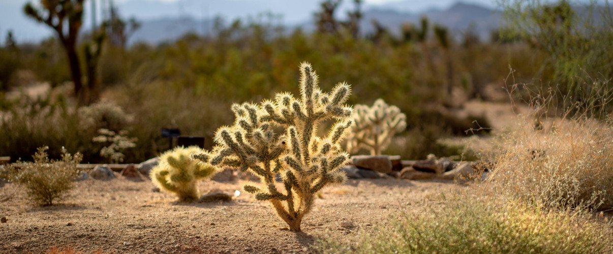
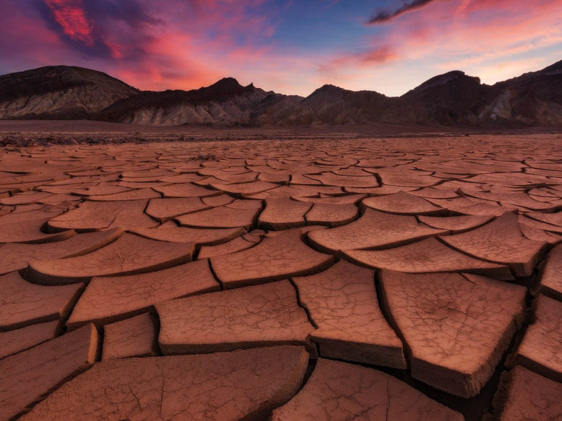
Covering approximately 48,000 square miles across California, Nevada, Utah, and Arizona, the Mojave Desert is known for its iconic Joshua trees and extreme temperatures. Death Valley, North America's hottest and driest location, lies within this desert, holding the record for the highest temperature ever recorded on Earth (134°F/56.7°C in 1913).
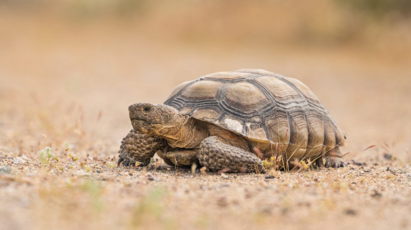
The Mojave's landscape varies dramatically from salt flats 282 feet below sea level at Badwater Basin to mountain ranges exceeding 11,000 feet. This elevation range creates diverse habitats supporting specialized species like the desert tortoise, chuckwalla lizard, and numerous wildflowers that burst into magnificent blooms after rare rainfalls.
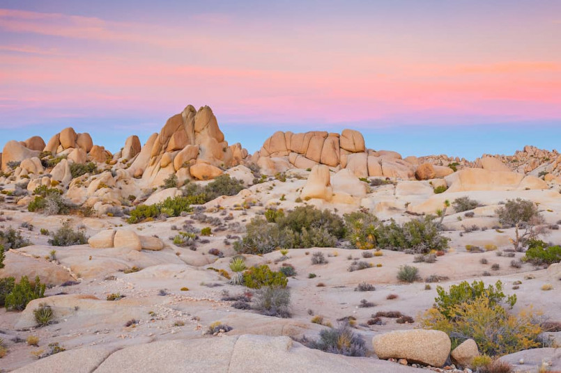
Joshua Tree National Park, where the Mojave meets the Colorado Desert (a subdivision of the Sonoran), offers world-class rock climbing, hiking, and photography opportunities. The desert's striking landscapes have inspired artists, filmmakers, and musicians for generations.
Sonoran Desert
The Sonoran Desert spans approximately 100,000 square miles across the southwestern United States and northwestern Mexico. What distinguishes the Sonoran from other North American deserts is its relatively lush appearance and unique biodiversity, supported by a biannual rainfall pattern.
This desert is the only place where the iconic saguaro cactus grows naturally. These majestic plants can reach heights of 40-60 feet and live for 150-200 years. The Sonoran also hosts over 2,000 plant species, including palo verde trees, ocotillo, and numerous cacti varieties.
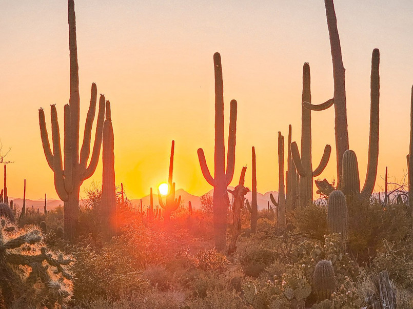
Saguaro National Park near Tucson, Arizona, protects vast forests of these emblematic cacti. The Sonoran Desert's remarkable biodiversity also includes the endangered Sonoran pronghorn, gila monsters, and more than 350 bird species, making it a paradise for wildlife enthusiasts.
Chihuahuan Desert
The Chihuahuan Desert extends across approximately 175,000 square miles, with about 30% lying within the United States (primarily in Texas and New Mexico) and the remainder in Mexico. As North America's largest desert, it's characterized by higher elevations (generally 3,500-5,000 feet) than its western counterparts.
This desert receives more summer rainfall than other American deserts, supporting distinctive flora including lechuguilla, various yucca species, and creosote bushes. The Chihuahuan's biodiversity is remarkable, hosting more than 3,500 plant species, with approximately 1,000 being endemic to the region.
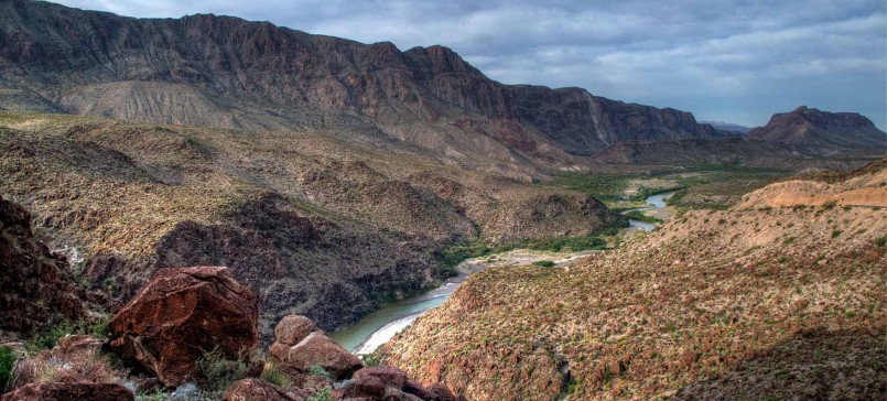
Big Bend National Park showcases the Chihuahuan Desert's spectacular scenery, where the desert meets the Rio Grande. Carlsbad Caverns National Park, with its extraordinary underground limestone chambers, and White Sands National Park, featuring the world's largest gypsum dune field, also lie within this desert region.
Colorado Plateau
While technically a high desert or semi-arid region, the Colorado Plateau covers about 130,000 square miles across the Four Corners region of Utah, Colorado, New Mexico, and Arizona. With an average elevation of 5,000-7,000 feet, this plateau experiences greater temperature extremes and slightly higher precipitation than lower deserts.
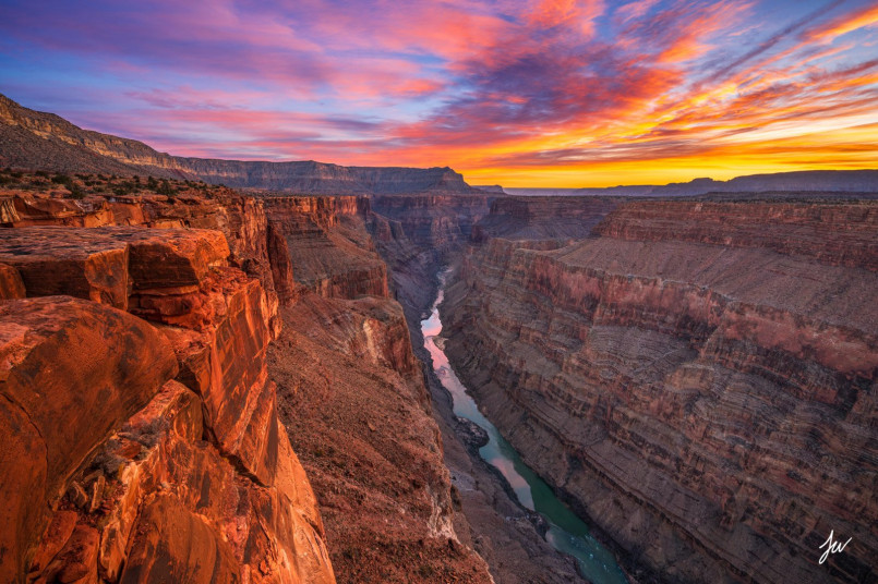
The plateau's most distinctive feature is its spectacular geology - a wonderland of colorful sedimentary rock layers carved into canyons, mesas, buttes, and spires. The Colorado River and its tributaries have sculpted iconic landscapes including the Grand Canyon, which exposes nearly two billion years of Earth's history in its walls.
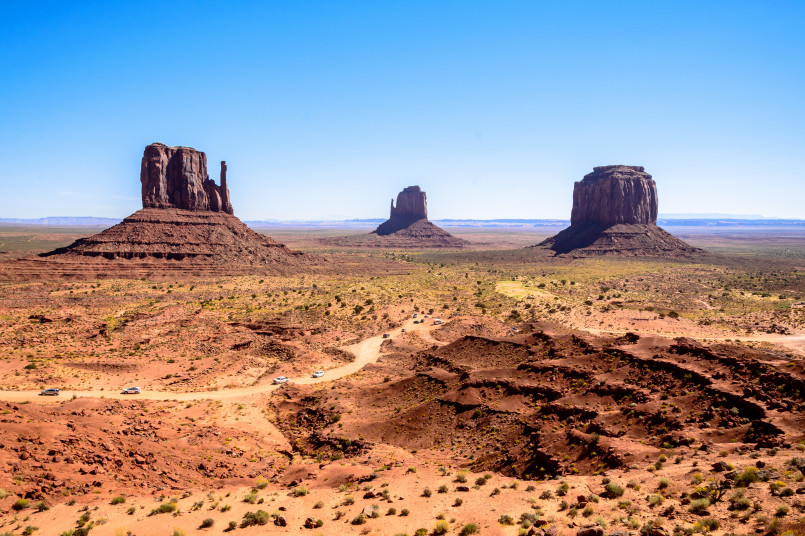
The Colorado Plateau hosts the highest concentration of national parks in America, including Zion, Bryce Canyon, Arches, Canyonlands, Capitol Reef, and Grand Canyon. These protected areas draw millions of visitors annually to witness some of the most spectacular desert scenery on the planet.
Painted Desert
Part of the larger Colorado Plateau, the Painted Desert stretches across approximately 7,500 square miles in northeastern Arizona. Its name derives from the vibrant bands of color that streak across its badlands - hues of lavender, red, orange, yellow, and gray - created by iron, manganese, and other minerals in the sedimentary layers.
This desert's most remarkable feature is Petrified Forest National Park, where ancient logs have transformed into brilliantly colored stone through the process of permineralization. Dating back to the Late Triassic period (about 225 million years ago), these petrified trees provide crucial insights into prehistoric ecosystems.
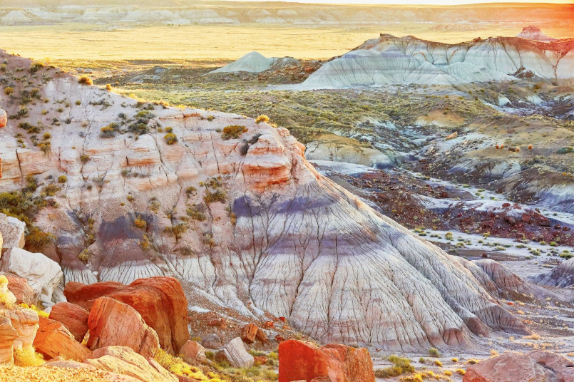
The Painted Desert's landscape includes mesas, buttes, and badlands formations that have been shaped by millions of years of erosion. Indigenous peoples, particularly the Navajo and Hopi, have deep cultural connections to this land, which features in many of their origin stories and spiritual practices.
Black Rock Desert
Located in northwestern Nevada, the Black Rock Desert spans approximately 1,000 square miles of playa (dry lake bed) surrounded by mountain ranges. This flat, barren expanse was once the bed of ancient Lake Lahontan, which covered much of Nevada during the last ice age.
The desert's most distinctive feature is its remarkably flat and hard surface, which has made it popular for land speed records. The current world land speed record of 763 mph was set here in 1997. The playa's unique properties also make it ideal for the annual Burning Man festival, which temporarily transforms the desert into one of Nevada's largest communities.
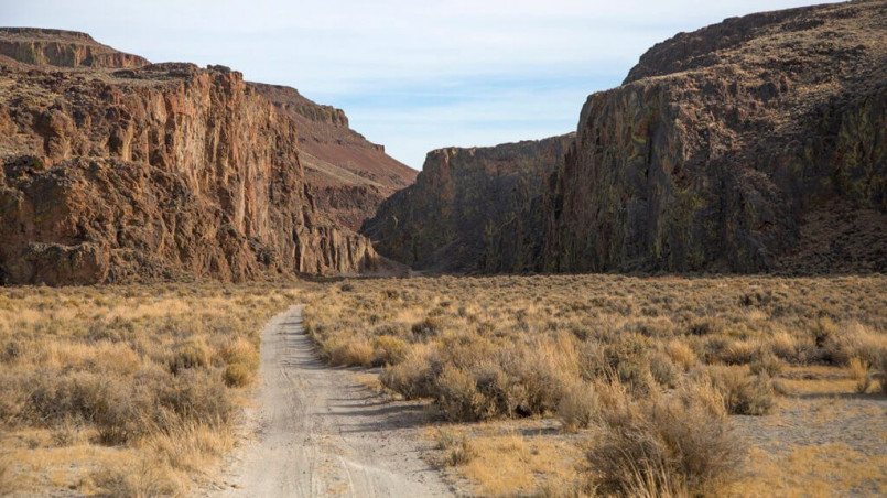
Beyond the playa, the Black Rock Desert-High Rock Canyon Emigrant Trails National Conservation Area protects rugged canyons, hot springs, and volcanic features. The region preserves sections of the historic Applegate-Lassen emigrant trail and contains significant archaeological sites dating back thousands of years.
Desert Conservation Efforts
America's deserts face numerous threats, including urban development, energy projects, mining, off-road vehicle use, invasive species, and climate change. Conservation efforts have established protected areas across desert regions, with national parks, monuments, and wilderness areas safeguarding approximately 10% of U.S. desert lands.
The California Desert Protection Act of 1994 and the Desert Renewable Energy Conservation Plan represent significant legislative efforts to balance conservation with development. Organizations like the Desert Conservation Program work to protect endangered species such as the desert tortoise, while initiatives to reduce water consumption in desert cities help preserve limited groundwater resources.
Sustainable tourism practices are increasingly important as visitation to desert parks grows. Many conservation groups promote responsible recreation through education about proper desert hiking protocols, cultural site preservation, and minimizing impact on fragile desert soils and vegetation.
Frequently Asked Questions About 7 Magnificent Deserts in the United States: Nature's Sandy Wonders
What is the largest desert in the United States?
The Great Basin Desert is the largest desert in the United States, covering approximately 190,000 square miles across Nevada, Utah, Idaho, and Oregon. It's classified as a 'cold desert' due to its higher elevations and cold winters, unlike the hot deserts of the Southwest.
What makes the Sonoran Desert unique compared to other American deserts?
The Sonoran Desert is unique for its biannual rainfall pattern, which supports greater biodiversity than other North American deserts. It's the only place where the iconic saguaro cactus grows naturally and hosts over 2,000 plant species. Its relatively lush appearance with trees like palo verde and diverse cacti species distinguishes it from more sparse desert landscapes.
When is the best time to visit American deserts?
The best time to visit American deserts is during the cooler months from October through April. Spring (March-April) often features wildflower blooms if winter precipitation has been sufficient. Summer temperatures regularly exceed 100°F (38°C) and can reach dangerous levels, particularly in lower elevation deserts like Death Valley and the Mojave.
Are American deserts completely dry year-round?
No, American deserts do receive precipitation, but typically less than 10 inches annually. The timing varies by desert type - the Sonoran has a bimodal pattern with winter and summer rains, while the Mojave receives most precipitation in winter. The Chihuahuan Desert gets more summer rainfall from monsoon patterns. Flash floods can occur despite the general aridity.
What types of wildlife can be found in American deserts?
American deserts support surprising biodiversity including iconic species like the desert tortoise, Gila monster, roadrunner, and bighorn sheep. Smaller creatures like kangaroo rats, pocket mice, and various lizards are common. Predators include coyotes, bobcats, and mountain lions. Bird diversity is particularly high in the Sonoran Desert with over 350 species. Many desert animals are nocturnal to avoid daytime heat.
How do the different American deserts compare in elevation?
American deserts vary significantly in elevation, which affects their climate and ecology. The Great Basin and Colorado Plateau are high deserts (generally 4,000-7,000 feet elevation) with colder winters. The Chihuahuan Desert averages 3,500-5,000 feet. The Mojave includes both high points and Death Valley at 282 feet below sea level. The Sonoran Desert is generally lower, with much below 2,000 feet elevation.
