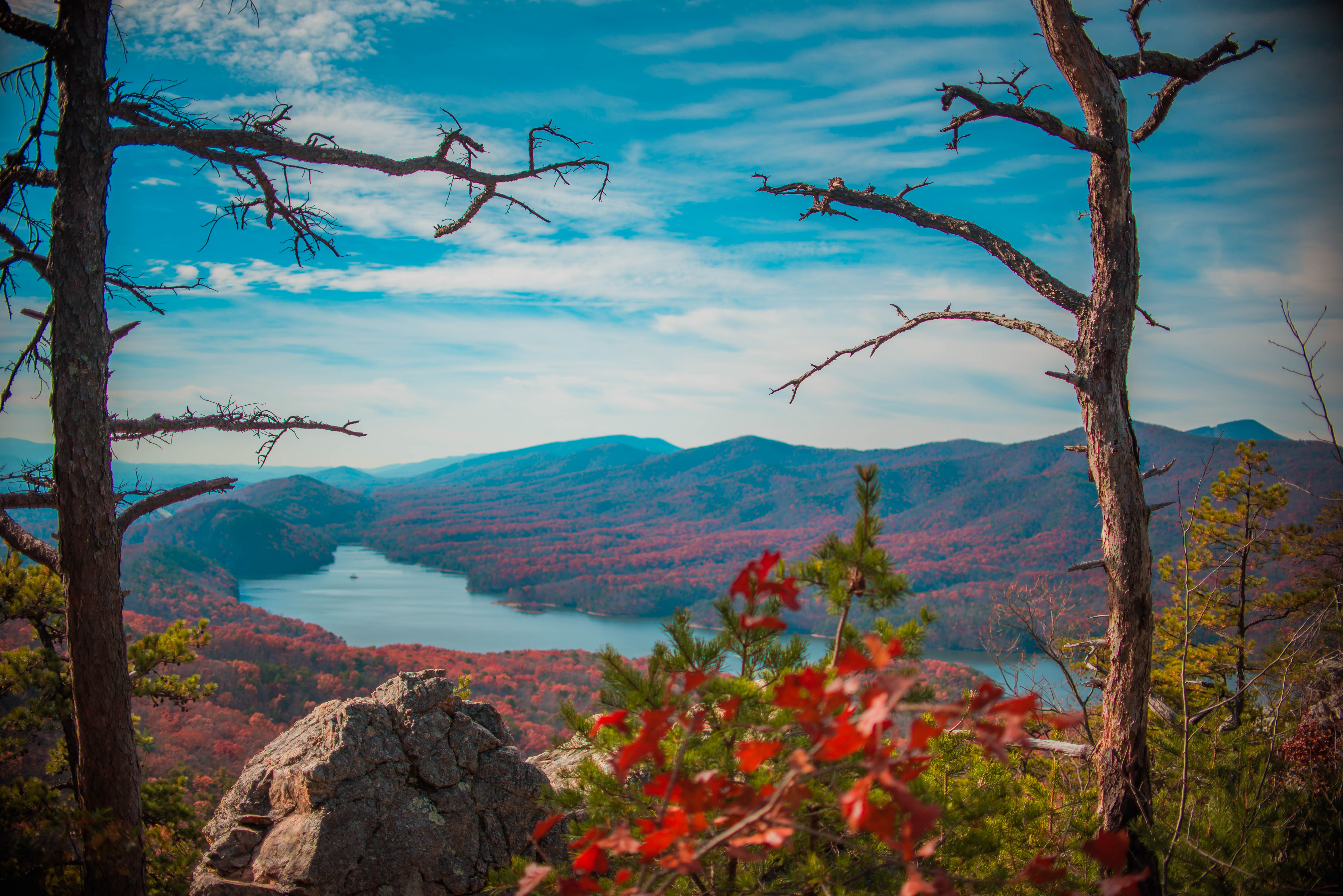
America's vast landscapes offer some of the world's most spectacular hiking experiences. From the 2,190-mile Appalachian Trail to the rim paths of the Grand Canyon, these famous trails showcase the country's diverse natural beauty and provide unforgettable adventures for outdoor enthusiasts of all skill levels.
America's wilderness beckons hikers with some of the most spectacular trails in the world. From coast to coast, these iconic paths wind through diverse landscapes, offering adventures that range from afternoon excursions to multi-month journeys. Each trail tells a story of America's natural heritage and provides access to breathtaking vistas that can only be reached on foot.
These famous hiking trails have earned their reputations through a combination of natural beauty, unique challenges, and historical significance. Whether you're an experienced thru-hiker or a casual day-tripper, these trails offer something for everyone who seeks to experience America's wild places.
Appalachian Trail
The Appalachian Trail stands as America's most iconic long-distance hiking path, stretching approximately 2,190 miles from Georgia to Maine. This legendary trail traverses 14 states and takes most thru-hikers 5-7 months to complete. Established in 1937, the AT (as it's affectionately known) passes through numerous national forests, parks, and state lands.
Each year, thousands attempt to hike the entire trail, with only about 25% succeeding. The trail offers diverse terrain from the southern Appalachians' lush forests to New Hampshire's rugged White Mountains. Mount Katahdin in Maine marks the northern terminus, while Springer Mountain in Georgia serves as the southern endpoint.

The trail community has developed its own culture, complete with traditions like trail names and trail magic (unexpected acts of kindness from strangers). For those not ready to commit to a thru-hike, countless sections make perfect day or weekend hikes.
Pacific Crest Trail
Stretching 2,650 miles from Mexico to Canada, the Pacific Crest Trail traverses some of the most stunning landscapes in California, Oregon, and Washington. Made even more famous by Cheryl Strayed's memoir "Wild," this trail takes hikers through 25 national forests and 7 national parks.
The PCT showcases incredible ecological diversity, from the Mojave Desert to the alpine regions of the Sierra Nevada and Cascade mountain ranges. Hikers face challenging elevation changes, with the trail reaching over 13,000 feet at Forester Pass in the Sierra Nevada.

Thru-hiking the PCT typically takes 4-6 months, with most hikers traveling northbound starting in April or May to avoid dangerous snow conditions in the mountains. The trail's popularity has surged in recent years, with permit systems now in place to manage impact.
John Muir Trail
The John Muir Trail covers 211 miles through California's Sierra Nevada mountains, passing through Yosemite, Kings Canyon, and Sequoia National Parks. Named for naturalist John Muir, this trail is renowned for its consistently spectacular high-mountain scenery.
The JMT shares approximately 170 miles with the Pacific Crest Trail and culminates at Mount Whitney, the highest peak in the contiguous United States at 14,505 feet. Most hikers take 2-3 weeks to complete the journey, encountering pristine alpine lakes, massive granite formations, and breathtaking mountain passes along the way.
With its average elevation exceeding 8,000 feet and numerous passes over 11,000 feet, the JMT presents a high-altitude challenge. However, the well-maintained trail and spacing of resupply points make it more accessible than some longer trails. The hiking season typically runs from July through September when mountain passes are free of snow.
Grand Canyon Rim Trails
The Grand Canyon Rim Trails offer some of the most accessible yet spectacular hiking in America. The South Rim Trail extends for 13 miles with paved sections and shuttle bus access points, making it ideal for casual hikers seeking world-class views. The more remote North Rim Trail provides a quieter experience with equally stunning vistas.
These trails allow hikers to experience the grandeur of the canyon without the strenuous descent into the gorge itself. The South Rim is open year-round, while the North Rim facilities typically operate only from mid-May to mid-October due to heavy winter snowfall.

For those seeking longer adventures, the Rim-to-Rim hike traverses the entire canyon, typically using the North Kaibab Trail from the North Rim and either the Bright Angel or South Kaibab Trail from the South Rim. This challenging 21-24 mile journey requires careful planning and usually an overnight stay at Phantom Ranch or a campground at the bottom.
Angels Landing
Zion National Park's Angels Landing trail is perhaps America's most thrilling short hike. This 5.4-mile round trip climbs 1,488 feet to a narrow sandstone ridge with 1,000-foot drop-offs on either side. The final half-mile features chains bolted into the rock to help hikers navigate the exposed sections.
The payoff is worth the challenge: panoramic views of Zion Canyon's colorful walls and the winding Virgin River below. Due to its popularity and safety concerns, the National Park Service now requires permits for the chain section, available through a lottery system.
The trail begins at the Grotto Trailhead, accessible via the park's shuttle system. After a series of switchbacks known as Walter's Wiggles, hikers reach Scout Lookout, where those uncomfortable with heights often turn around. Even without completing the chain section, the hike offers spectacular views.
Half Dome
Yosemite National Park's Half Dome hike is one of America's most coveted day hikes. This strenuous 14-16 mile round-trip journey culminates in an ascent up the dome's eastern face using steel cables as handrails. The cables allow hikers to climb the final 400 vertical feet without technical climbing equipment.
From the summit at 8,842 feet, hikers enjoy panoramic views of Yosemite Valley and the High Sierra. The trail gains approximately 4,800 feet of elevation and typically takes 10-12 hours to complete. Due to its popularity, a permit system limits daily traffic to 300 hikers.

The hiking season generally runs from late May through October, when the cables are up. Most hikers begin before dawn to complete the round trip in daylight. The route passes iconic Yosemite landmarks including Vernal and Nevada Falls before reaching the base of the dome.
Continental Divide Trail
The Continental Divide Trail spans approximately 3,100 miles from Mexico to Canada along the Continental Divide, the mountainous spine that separates watersheds draining to the Pacific and Atlantic Oceans. As the most rugged of America's triple crown hiking trails (along with the AT and PCT), the CDT remains a supreme wilderness challenge.
Traversing five states-New Mexico, Colorado, Wyoming, Idaho, and Montana-the trail passes through diverse ecosystems from desert to alpine tundra. Highlights include Colorado's San Juan Mountains, Wyoming's Wind River Range, and Montana's Glacier National Park.
Unlike other long trails, sections of the CDT remain primitive or unmarked, requiring strong navigation skills. Only about 150 hikers complete the entire trail each year. The CDT offers a true wilderness experience, with hikers often going days between resupply points and encountering few other people.
Wonderland Trail
Circling Washington's iconic Mount Rainier, the 93-mile Wonderland Trail offers a comprehensive tour of one of America's most impressive volcanoes. This challenging loop gains and loses over 22,000 feet of elevation as it traverses varied terrain from old-growth forests to subalpine meadows and glacial valleys.
Most hikers take 9-13 days to complete the loop, staying at designated backcountry camps along the way. The trail's popularity requires securing wilderness permits well in advance through a competitive reservation system.
The prime hiking season runs from July through September when mountain passes are typically free of snow. Hikers are rewarded with constantly changing perspectives of 14,411-foot Mount Rainier and encounters with diverse wildlife and wildflowers that change with elevation.
Kalalau Trail
Hawaii's Kalalau Trail along Kauai's Nā Pali Coast offers 11 miles of the most dramatic coastal scenery in America. This challenging trail traverses five valleys before ending at Kalalau Beach, accessible only by foot or boat. With steep cliffs dropping into the Pacific Ocean, the path demands respect and careful footing.
The trail's beauty comes with significant challenges: narrow paths along cliff edges, stream crossings that can become dangerous after rain, and the infamous Crawler's Ledge section that tests hikers' nerve. A permit is required to hike beyond Hanakāpī'ai Valley (2 miles in) and for camping at Kalalau Beach.

Many hikers opt for the 4-mile round-trip day hike to Hanakāpī'ai Beach, which doesn't require a permit but still showcases the coast's beauty. The trail is often wet and muddy, adding to the challenge but also contributing to the lush vegetation that makes this tropical hike unique.
Bright Angel Trail
The Bright Angel Trail is the Grand Canyon's most popular path into the canyon depths. This well-maintained trail descends 4,380 feet from the South Rim to the Colorado River over 9.5 miles. With regular rest houses, water stations (seasonal), and ranger presence, it offers a safer canyon experience than more primitive routes.
Day hikers typically venture to either the 1.5-Mile or 3-Mile Resthouse before returning, as the National Park Service strongly discourages attempting to hike to the river and back in a single day due to extreme heat and elevation change. For those planning an overnight trip, Bright Angel Campground near the river provides a basecamp with advance permits.
The trail follows a natural fault line and was used by Native Americans for centuries before being developed for tourism in the early 20th century. Its relatively gentle grade (compared to other canyon trails) and afternoon shade make it the preferred route for ascending from the inner canyon.
Highline Trail
Glacier National Park's Highline Trail offers hikers an unforgettable alpine experience along the Continental Divide. Beginning at Logan Pass on the Going-to-the-Sun Road, this trail follows the Garden Wall, a dramatic knife-edge ridge, for approximately 11.6 miles to the Granite Park Chalet.
The path clings to mountainsides high above the valley floor, providing continuous panoramic views of the park's glaciated peaks, alpine meadows, and potential wildlife sightings including mountain goats and bighorn sheep. The initial quarter-mile features a narrow ledge with a cable handhold for safety.

Most hikers arrange a shuttle by taking the Loop Trail down to the Going-to-the-Sun Road after reaching the Granite Park area. The optimal hiking season is brief, typically from mid-July through September when the high country is free of snow. Afternoon thunderstorms present a hazard in this exposed terrain.
Hoh River Trail
Olympic National Park's Hoh River Trail takes hikers through one of America's finest examples of temperate rainforest. This 17.3-mile trail (one way) follows the Hoh River from the visitor center to Glacier Meadows, the closest camp to Mount Olympus.
The first portion of the trail is flat and accessible, showcasing the rainforest's massive moss-draped trees, some exceeding 200 feet tall and 500 years in age. The understory bursts with ferns, fungi, and other moisture-loving plants that thrive in the 140+ inches of annual rainfall.
Day hikers often venture to the 5-mile marker at Five Mile Island for a taste of the rainforest experience. Backpackers continuing to Glacier Meadows face increasingly steep terrain as the trail climbs toward the mountains. The Blue Glacier on Mount Olympus is accessible via a side trail from Glacier Meadows, though this requires mountaineering skills.
Long Trail
Vermont's Long Trail is America's oldest long-distance hiking path, established in 1910. This 272-mile footpath follows the main ridge of the Green Mountains from the Massachusetts-Vermont border to Canada, traversing Vermont's highest peaks including Mount Mansfield at 4,393 feet.
The southern 100 miles of the Long Trail coincide with the Appalachian Trail before the AT branches east toward New Hampshire. The northern sections become increasingly remote and rugged, offering a more wilderness-oriented experience.
The trail features a system of about 70 shelters and campsites spaced a day's hike apart. While some hardy hikers tackle the trail in winter, most complete their journeys between June and October. Fall offers spectacular foliage displays but also requires preparation for colder temperatures, especially at higher elevations.
The Narrows
Zion National Park's Narrows offers one of America's most unique hiking experiences: wading through the Virgin River as it carves its way through towering canyon walls that narrow to just 20-30 feet apart in some places. The walls soar up to 1,000 feet overhead, creating a dramatic slot canyon experience.
Most visitors experience The Narrows by hiking upstream from the Temple of Sinawava and turning around when they wish. This requires no permit and can extend up to 10 miles round trip. For the full 16-mile top-down experience starting at Chamberlain's Ranch, hikers need a wilderness permit and typically complete it as an overnight trip.

Proper preparation is essential, as hikers wade through water for much of the journey. Specialized canyon footwear, walking sticks, and dry bags for gear are strongly recommended. The Narrows is subject to closure during spring runoff and whenever flash flood risk is present, making summer and early fall the most reliable seasons.
Mist Trail
Yosemite National Park's Mist Trail is perhaps America's most spectacular waterfall hike. This popular trail takes hikers up close to two of Yosemite's iconic waterfalls: Vernal Fall (317 feet) and Nevada Fall (594 feet).
The trail earned its name from the refreshing spray that drenches hikers as they climb the granite steps alongside Vernal Fall in spring and early summer. This 3-mile round trip to the top of Vernal Fall gains 1,000 feet in elevation and offers jaw-dropping views of the waterfall's rainbow-filled mist.
More ambitious hikers can continue to Nevada Fall, making it a 7-mile round trip with 1,900 feet of elevation gain. The loop option returning via the John Muir Trail provides different perspectives and is often less crowded. Stone staircases can be slippery when wet, making sturdy footwear essential. The trail is accessible year-round, though winter conditions may require traction devices.
Frequently Asked Questions About 15 Most Epic Hiking Trails in America That Will Take Your Breath Away
Which famous American hiking trail is best for beginners?
The Grand Canyon Rim Trails are ideal for beginners, offering relatively flat terrain with spectacular views and the ability to customize your distance. The Bright Angel Trail (first 1.5 miles) in the Grand Canyon and portions of the Mist Trail in Yosemite are also good options with clear paths and ranger presence, though they do involve some elevation change.
When is the best time to hike the Pacific Crest Trail?
Most Pacific Crest Trail thru-hikers begin at the Mexican border in late April to early May, which allows them to cross the Sierra Nevada after peak snowmelt (typically June) and reach Washington before early October snowfalls. Section hikers should research their specific region, as optimal times vary dramatically from the desert sections (spring/fall) to the high mountains (summer).
Do I need a permit to hike Angels Landing in Zion?
Yes, as of April 2022, hikers need a permit to climb the final section of Angels Landing (the chains portion). Permits are distributed through seasonal lottery and day-before lottery systems to manage crowds and improve safety on this popular trail. The trail up to Scout Lookout does not require a permit and still offers impressive views.
What is the Triple Crown of Hiking in America?
The Triple Crown of Hiking refers to completing America's three longest National Scenic Trails: the Appalachian Trail (2,190 miles), the Pacific Crest Trail (2,650 miles), and the Continental Divide Trail (3,100 miles). This achievement represents roughly 8,000 miles of hiking and typically takes years to complete, with fewer than 500 people having documented Triple Crown completions.
What equipment do I need for hiking The Narrows in Zion?
For The Narrows, specialized equipment is highly recommended: closed-toe shoes with good ankle support (or rented canyoneering boots), a hiking stick or trekking poles for balance in the current, dry bags for electronics and valuables, and quick-drying clothing (not cotton). In colder months (November-May), many hikers rent dry pants or full dry suits from outfitters in Springdale.
How far in advance should I apply for a Half Dome permit?
Applications for the Half Dome permit preseason lottery are accepted from March 1-31 each year for the upcoming hiking season (typically late May through mid-October). Results are announced in mid-April. The success rate varies by day of week, with weekday applications having roughly a 25-30% success rate while weekend applications can drop to 15% or lower. A limited number of daily permits are also available in a two-days-in-advance lottery during the season.
Which famous American hiking trails can be completed in a single day?
Famous day-hikeable trails include Angels Landing (5.4 miles), Mist Trail to Nevada Fall (7 miles), Half Dome (14-16 miles for very fit hikers), Highline Trail (11.6 miles one-way with shuttle), portions of The Narrows (up to 10 miles round-trip), and shorter sections of any of the long-distance trails. Remember that elevation gain, terrain difficulty, and weather conditions affect completion time more than mere distance.
What is the most scenic section of the Appalachian Trail?
Many hikers consider the White Mountains of New Hampshire to be the most scenic section of the Appalachian Trail, with alpine zones, dramatic views, and challenging terrain. Other highly-rated scenic sections include the Great Smoky Mountains National Park in Tennessee/North Carolina, Roan Highlands on the Tennessee/North Carolina border, and Maine's 100-Mile Wilderness leading to Mount Katahdin.


