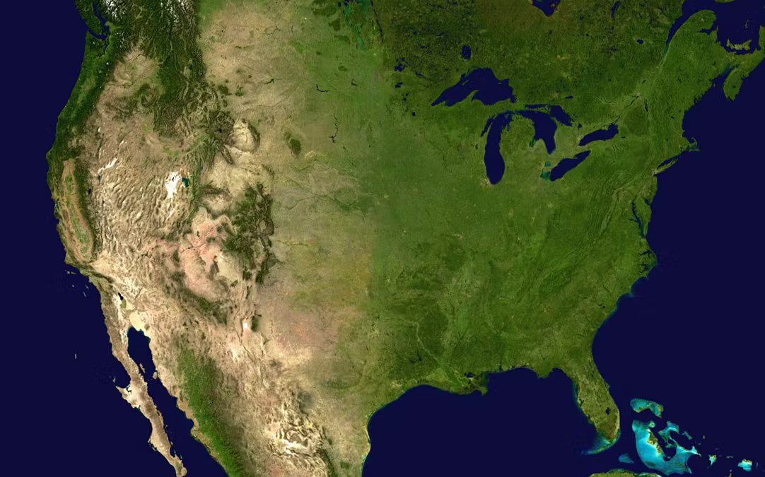
The United States of America stands as one of the world's largest and most geographically diverse nations, covering an impressive expanse of 3,796,742 square miles. This vast territory encompasses 3,531,905 square miles of land and 264,837 square miles of inland waters, creating a nation of extraordinary scale and variety.
| Dimension | Measurement |
|---|---|
| Total Area | 3,796,742 sq miles |
| Land Area | 3,531,905 sq miles |
| Water Area | 264,837 sq miles |
| East-West Distance | 2,800 miles |
| North-South Distance | 1,582 miles |
| Coastline Length | 95,471 miles |
| International Borders | 7,458 miles |
A Nation of Continental Proportions
The sheer size of the continental United States is difficult to comprehend without context. Stretching 2,800 miles from the Atlantic to the Pacific and 1,582 miles from Canada to Mexico, the nation's mainland is a testament to geographic grandeur. Its 95,471 miles of coastline trace three major oceans, while 7,458 miles of international borders connect it with its North American neighbors.
To put this magnitude in perspective, the United States nearly matches the entire European continent in size. It's roughly 40 times larger than the United Kingdom, slightly larger than China, and occupies about half the area of Russia, the world's largest country. Within its borders, you could fit the European Union two and a half times over.
| Country | Total Area (sq miles) | Area Comparison | Population (2024) | Population Ratio | Pop. Density (per sq mile) |
|---|---|---|---|---|---|
| Russia | 6,601,670 | 1.8x larger | 144,444,359 | 0.43x smaller | 22 |
| United States | 3,796,742 | - | 335,893,238 | - | 88 |
| China | 3,705,407 | 2% smaller | 1,411,750,000 | 4.2x larger | 381 |
| Canada | 3,855,103 | 2% larger | 40,097,761 | 8.4x smaller | 10 |
| Brazil | 3,287,956 | 13% smaller | 214,893,000 | 0.64x smaller | 65 |
| Australia | 2,969,907 | 22% smaller | 26,473,000 | 12.7x smaller | 9 |
| European Union | 1,728,099 | 54% smaller | 447,706,209 | 1.3x larger | 259 |
| India | 1,269,219 | 67% smaller | 1,428,627,663 | 4.3x larger | 1,126 |
| Argentina | 1,068,296 | 72% smaller | 45,808,000 | 7.3x smaller | 43 |
| Mexico | 761,610 | 80% smaller | 130,207,371 | 2.6x smaller | 171 |
| France | 248,573 | 93% smaller | 68,042,591 | 4.9x smaller | 274 |
| Japan | 145,937 | 96% smaller | 125,124,989 | 2.7x smaller | 858 |
| United Kingdom | 93,628 | 97% smaller | 67,736,802 | 5.0x smaller | 723 |
Geographic Regions Sizes
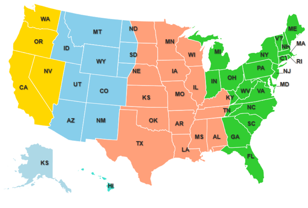
The United States is a mosaic of distinct geographic regions, each with its own character and natural wonders. The Northeast, though relatively compact at 181,324 square miles, cradles the ancient Appalachian Mountains and dense forests. The Southeast spreads across 536,787 square miles of subtropical coastlines, rolling hills, and extensive wetlands.
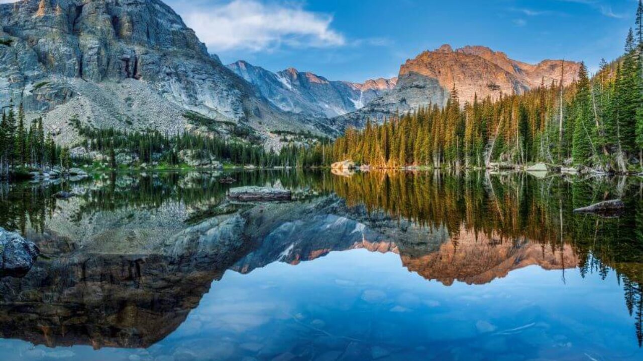
The heartland of America, the Midwest, spans 821,000 square miles of fertile plains and the mighty Great Lakes system. Further west, the Great Plains stretch across 500,000 square miles, forming North America's breadbasket with its vast prairies and grasslands. The Rocky Mountain region commands 855,000 square miles of majestic peaks and high deserts, while the Pacific region encompasses 637,794 square miles of diverse landscapes from rainforests to deserts.
Beyond the contiguous states, Alaska adds another 663,268 square miles of subarctic wilderness, while Hawaii contributes 10,932 square miles of tropical paradise to the nation's territory.
Beyond the States: America's Territories
Beyond the 50 states, the United States includes several territories that add significantly to its total area. Puerto Rico, the largest territory at 3,515 square miles, represents nearly half of America's territorial land mass. The U.S. Virgin Islands contribute an additional 133 square miles of land area.
In the Pacific region, Guam adds 210 square miles, while the Northern Mariana Islands encompass 183 square miles, and American Samoa comprises 77 square miles. When combined, these territories expand America's total land area by approximately 4,000 square miles.
The territories' maritime boundaries dramatically increase America's total controlled area through Exclusive Economic Zones, extending U.S. resource rights over millions of additional square miles of ocean. This combination of land and maritime territory makes the United States one of the world's largest nations in terms of total controlled area.
Natural Wonders and Geographic Extremes
Within these regions, the United States showcases some of Earth's most remarkable natural features. The Missouri-Mississippi River system, stretching 3,902 miles, forms the world's fourth-longest river system. Denali, North America's highest peak, soars to 20,310 feet in Alaska, while Death Valley in California plunges to 282 feet below sea level, marking the continent's lowest point.
The Great Lakes, crowned by Lake Superior with its 31,700 square miles of surface area, represent the largest freshwater system in the world. Underground, the Mammoth Cave system in Kentucky extends for more than 405 mapped miles, making it the world's longest known cave system.
States of Every Size
The diversity in state sizes adds another layer to America's geographic story. Alaska, the largest state, could contain Texas, the second-largest, more than twice over. California, ranking third, showcases how even one of the largest states offers dramatically different landscapes within its borders. At the other end of the spectrum, Rhode Island and Delaware demonstrate that small states can still pack remarkable geographic diversity into their modest dimensions.
America's Water World
Water features play a crucial role in shaping America's geography. The Great Lakes alone contain enough water to cover the entire United States in 9.5 feet of water. The nation's river network spans an incredible 3.5 million miles, while over 125,000 lakes dot the landscape. This extensive water system not only provides vital resources but has also shaped the nation's development and continues to influence its climate and ecosystems.


